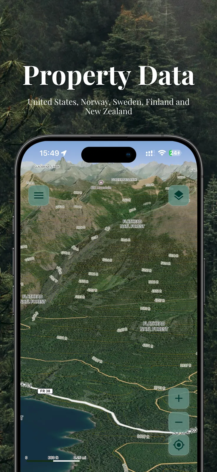
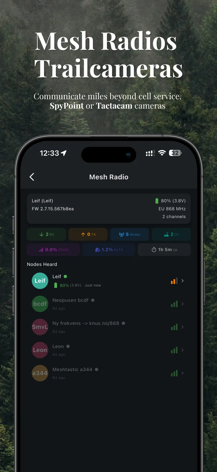
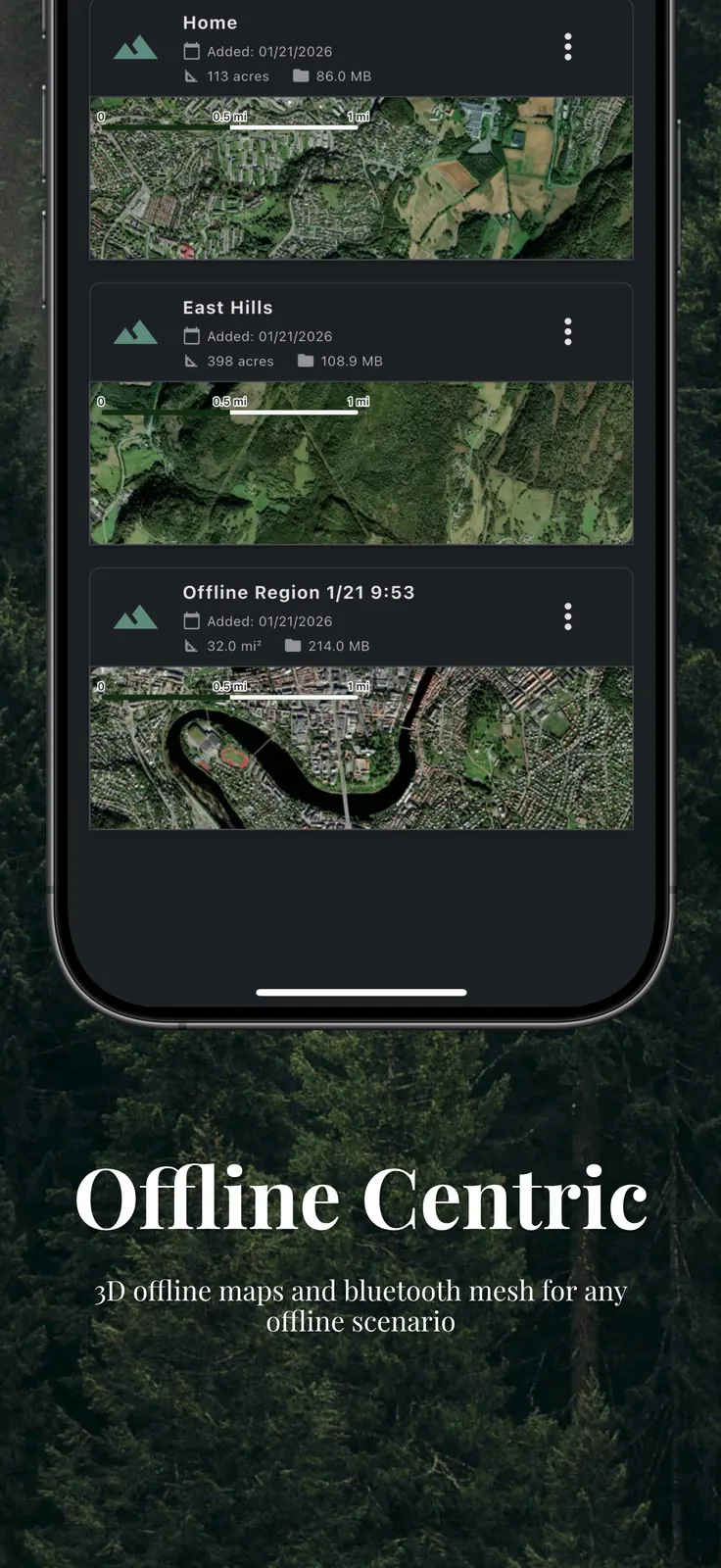
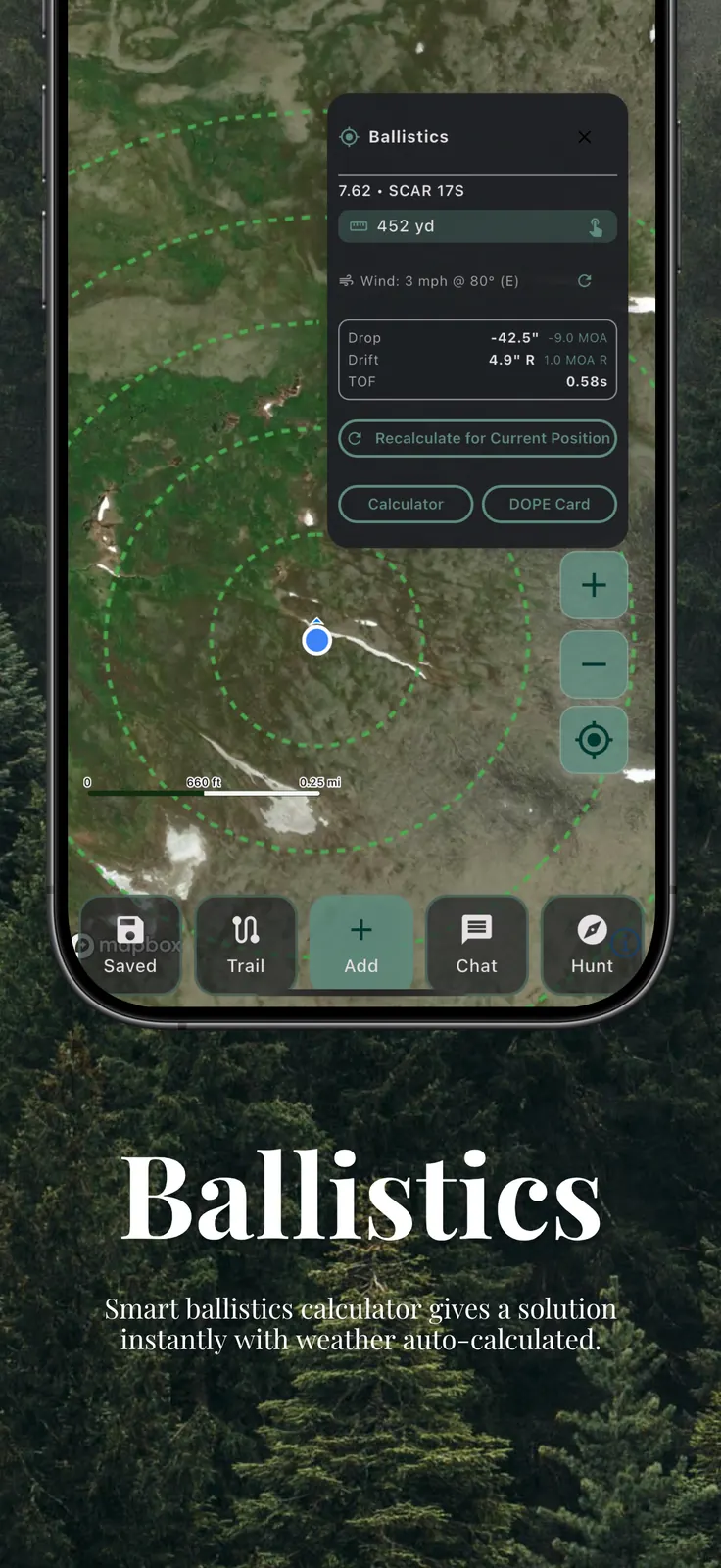
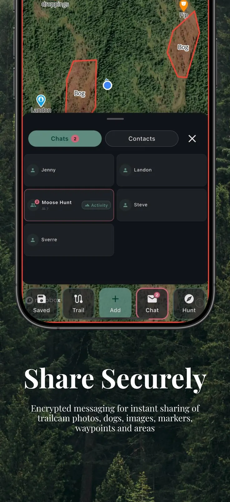
The only hunting app with property boundaries, a ballistics calculator, and encrypted mesh communication that works without cell service, WiFi, or internet.
Tap to enlarge
Why you need CoHunt:
Visualize property boundaries and land ownership data on your map. Currently covering the United States, Norway, Sweden, Finland, and New Zealand with more countries coming soon. Always know exactly where you can legally hunt.
Smart ballistics for any caliber with real-time weather data. Get trajectory, bullet drop, wind drift, and time of flight instantly. Export DOPE cards as PDF.
Connect a low cost Mesh LoRa radio for long-range off-grid messaging and location sharing. Reach your group miles away with zero infrastructure.
Share maps, logsitics, messages, waypoints, and much more directly between phones via Bluetooth. No cell service, no WiFi, no internet needed. Your hunting party stays connected in complete dead zones.
Invite-only groups with real-time GPS tracking, encrypted chat, and shared markers. Your location data never leaves your group and is never stored on our servers. No account required.
Plus everything you'd expect
Download detailed maps before your trip. Navigate confidently in areas with no cell coverage.
Record and share trails with your group. Save successful routes for future hunts.
Mark game sightings, tracks, and important locations. Share instantly with your group.
Track your hunting dogs in real-time. Share their location with your entire group for coordinated tracking.
Organize logistics and assign tasks to group members. Get real-time updates on preparation and field activities.
Advanced wind and scent dispersal modeling helps you position strategically based on weather conditions.
View photos and videos from your Spypoint trail cameras directly in CoHunt. AI species detection, camera status, and map placement all built in.
One plan. Every feature. Pick your commitment.
Every option includes all features, all map layers, zero ads, zero data collection.
Each competitor's comparable nationwide tier vs. CoHunt's single, all-inclusive plan.
| CoHunt $24.99/yr | onX Hunt $99.99/yr | BaseMap $99.99/yr | HuntStand $99.99/yr | WeHunt €85.99/yr | |
|---|---|---|---|---|---|
| Maps & Boundaries | |||||
| US Property Boundaries | |||||
| International Boundaries | Nordic only | ||||
| Offline Maps | |||||
| 3D Maps | iOS only | ||||
| Communication & Safety | |||||
| Encrypted Chat | Not encrypted | ||||
| Bluetooth Mesh Messaging | |||||
| Meshtastic LoRa Radio | |||||
| Real-Time Group Tracking | |||||
| Hunting Tools | |||||
| Ballistics Calculator | |||||
| Scent & Wind Analysis | |||||
| Dog Tracking | Basic | ||||
| Trail & GPX Export | Trail only | ||||
| Task Management | |||||
| Trail Camera Integration | Basic | ||||
| Equipment Tracking | Basic | ||||
| Privacy & Access | |||||
| No Account Required | |||||
| Zero Data Collection | |||||
| No Ads | |||||
| Annual Price | $24.99 | $99.99 | $99.99 | $99.99 | €85.99 |
Know where everyone in your party is at all times. Coordinate safely and prevent accidents with real-time location sharing.
Plan better hunts with weather data, saved trails, and collaborative mapping. Share successful spots and strategies with your trusted group.
Advanced peer-to-peer messaging keeps your group connected and coordinated. Share updates and stay in sync with your hunting partners.
Property boundary management ensures you always know where you can legally hunt. Build trust with landowners and fellow hunters.
Start using CoHunt to coordinate safer, more successful outdoor adventures with your hunting party.
Have questions or need support? We're here to help.
Have questions or want feature updates? Reach out anytime.
Email UsOr follow us for the latest